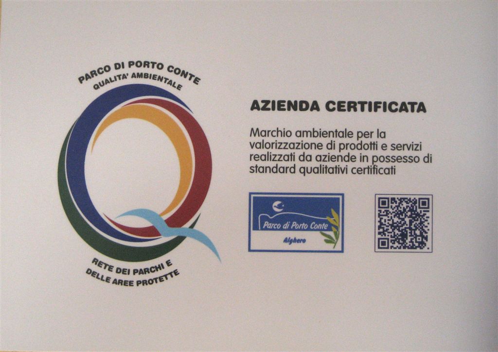
Quality label of the Park of Porto Conte: a new challenge for a sustainable future

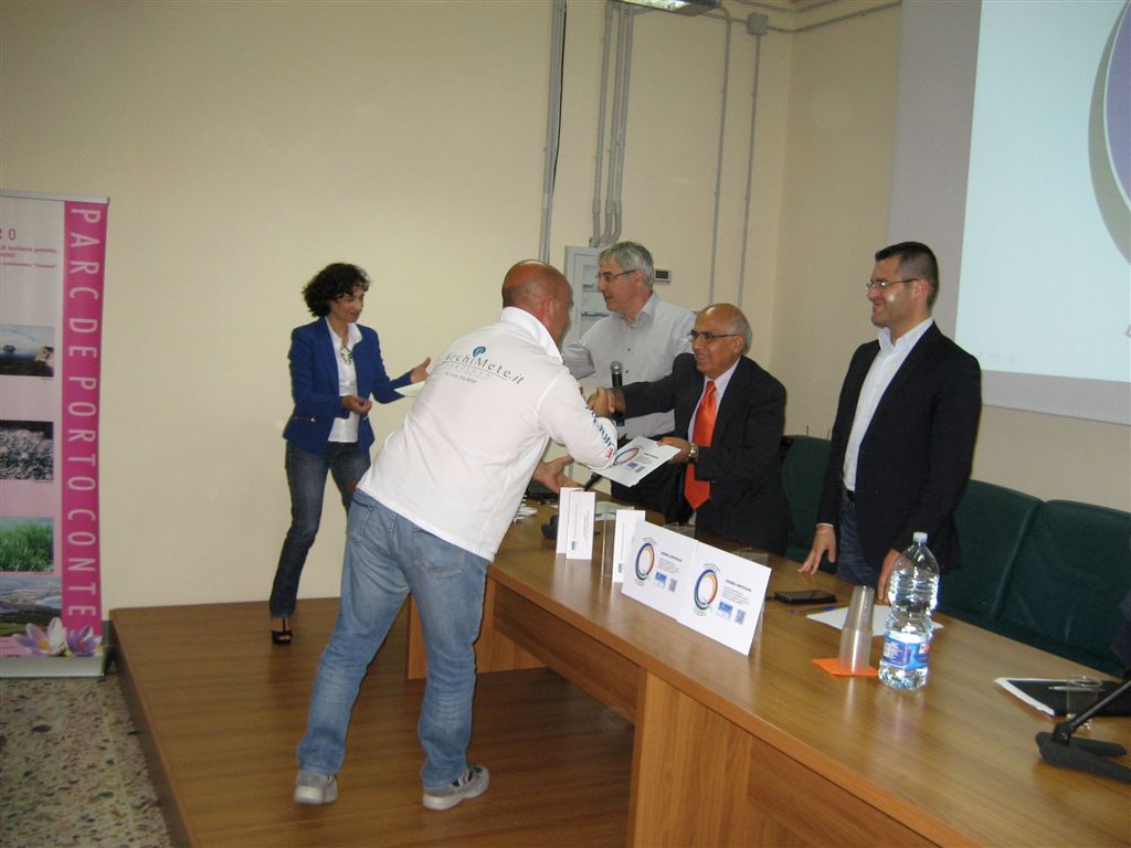
The official ceremony
The OveringDivingCenter, diving center linked to ArchiMete, got the Quality label of the Nature Park of Porto Conte, at Alghero in Sardinia. A symbol of quality, but also environmental sustainability and proper promotion of the territory.
On May 29, at Casa Gioiosa, HQ of the Park of Porto Conte, it was held the ceremony attended by the President of the Park Antonio Farris, the Director Vittorio Gazale, the vice-mayor of Alghero Raimondo Cacciotto, assessor economic development Natacha Lampis and the Director General of Laore Agency Maria Ibba.
The recognition of the label arrives at the end of a long process of precise commitments and corporate audits carried out by the technicians of the park, under the coordination of the biologist Marirosa Martinelli.
We fielded “eco-friendly” actions, such as water and energy saving, the employ of local personnel, use of local typical products, the use of marine engines with low emissions, the use of furniture made with “FSC” (Forest Stewardship Council) wood, the use of paper Revive Pure Natural Matt 100% recycled, certified Ecolabel for printing of promotional materials. In addition it is available for customers a shuttle service with minibus.
The Label of the Park means the specific desire to protect an area with natural and cultural resources unique and precious. Because it is only with the protection and attention to the territory as a whole (altro…)
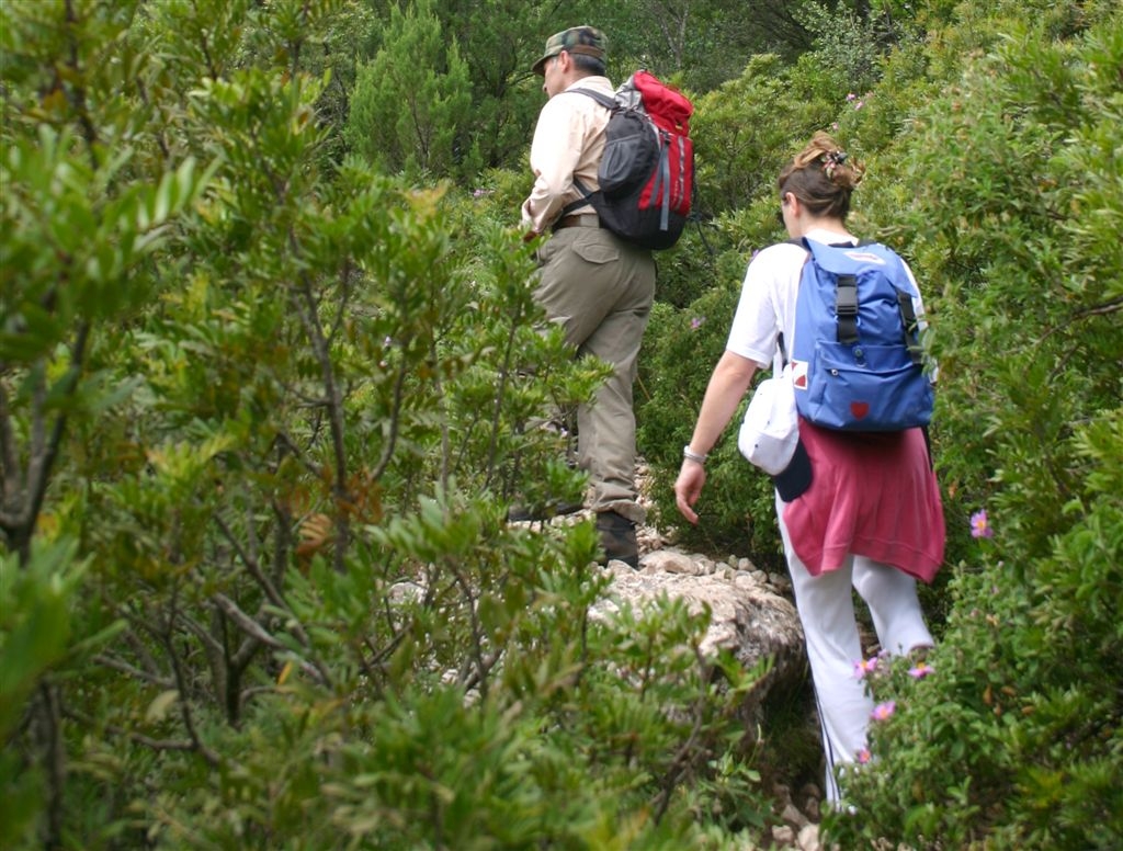
Hiking routes
.
Click on the image or here to enter the gallery
.
The tourist centre ArchiMete is a perfect departure point for hiking trails along the several naturalistic paths of the Regional Nature Park of Porto Conte. ![]() This activity is held with certified tourist guides leading groups of excursionists to the discovery of naturalistic, landscape, and cultural heritages present in this area. Click on the nearby icons to choose how to live your experience!
This activity is held with certified tourist guides leading groups of excursionists to the discovery of naturalistic, landscape, and cultural heritages present in this area. Click on the nearby icons to choose how to live your experience!
Service on demand. Send an e-mail to archimete@archimete.it
.
.
.

 .
.
.
.
.
.
.
.
.
.
.
.
.
.
Cala Inferno
This is another path of great naturalistic interest, tucked away into the maquis which overlook the blue sea of Capo Caccia. The tourist centre ArchiMete is a perfect departure point because, from here, and by bike or by car, it is possible to reach the junction of Cala Dragunara-Belvedere Foradada. Following the latter direction, you arrive at the viewpoint clearings, which look towards the western side of Capo Caccia. From here, the path classified as “advanced excursion” starts; a quite difficult route, which runs along a path facing the sea and the sheer drop which dominates Cala Inferno. This stretch of coast also presents two stunning snorkeling routes to discover the heritage of the Marine Protected Area of Capo Caccia-Isola Piana.
Torre del Bollo (the Bollo Tower)


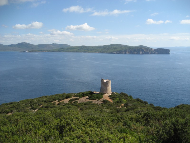
A path of great naturalistic and historical interest, since it is nestled among the Mediterranean maquis, in front of the blue sea of Capo Caccia, allowing one to admire historical artifacts, like the Torre del Bollo (the Bollo Tower), dating back to the Seventeenth century; belonging to a long chain of coastal lookout towers against pirates, plunderers and enemies. The tourist centre ArchiMete is a perfect departure point, because from here, and by foot, by bike or by car, it is possible to reach the small pier of Cala Dragunara. From there, you start going up in a South-East direction towards Capo Caccia, passing along paths which are tucked away among the maquis, including Cistus, junipers, wild rosemary, mastic trees and flourishing euphorbias. With just a turn of your head, you will be enchanted by the blue-green waters of Cala Dragunara and Porto Conte, including the little cape of Punta Giglio. There are so many beautiful things to see that the 400-500 metres length of the path pass quickly. In a few minutes time, you will reach a little hill, overlooked by the Torre del Bollo (the Bollo Tower), a fortified building of the Seventeenth century which was used, up until a few centuries ago, as a privileged outlook place. From here, a downhill path starts, taking you to the sea in just a few minutes, and close to Cala Dragunara. But the surprises aren’t finished yet: one of the most beautiful snorkeling routes of the Marine Protected Area of Capo Caccia-Isola Piana winds its way through this stretch of coast.
Punta Giglio
This is the side of the cape at the end of the western side of Porto Conte. The excursion, which lasts around 3 hours, marks a sort of ring, allowing you to admire the natural wonders of this part of the Regional Natural Park of Porto Conte, along with the breathtaking landscapes which contrast sharply with the dark blue of the Sardinian sea. During the walk, you will come across the ruins of platforms, used for the cannons of the antiaircraft artillery, along with bunkers and barracks used during the Second World War. The area is also suitable for biking and riding excursions, and it is located right on top of another important place for excursions; this time underwater: the Grotta dei Cervi (the Cave of Deer).
The ring of Capo Caccia
It is the most classic tour, but also the one that makes you enjoy one the most suggestive and natural landscapes of the area. The excursion lasts around 4 and a half hours, and winds its way through the heart of the Capo, with a drop of around 400 metres. The tourist centre ArchiMete is a perfect departure point; after just a few hundred metres walk among the flourishing maquis, you will reach the nice village of Tramariglio and, from here, the Tower of the Tramariglio port, and Cala Calcina. Then, moving towards the western side of the cape, it is possible to enjoy the suggestive landscape of Cala Inferno, which rises up from the sea and overlooks the Isola Foradada (Foradada Island). The rocks of granite are also nice convenient rest areas, where it is possible to refresh oneself, and get ready to continue towards the Capo, to eventually reach the Scala del Cabirol (Stair of the Roedeer), the departure point for visiting the Grotta di Nettuno (the Cave of Neptune). Once back on the main road, you will continue on a path along the cliff which goes up to the Torre del Pegna (the Tower of Pegna), located at 271 metres; then, from here, you will return to the enchanting Tramariglio bay for a refreshing bath or a moment of relaxation surrounded by nature.
 RSS Blog
Other informations
Search
Category
Tag Cloud
Archive
Febbraio 2022 (1)
Gennaio 2018 (1)
Maggio 2016 (1)
Gennaio 2016 (1)
Giugno 2015 (1)
Marzo 2015 (1)
Febbraio 2015 (1)
Ottobre 2014 (1)
Maggio 2014 (1)
Gennaio 2014 (1)
Ottobre 2013 (1)
Giugno 2013 (1)
Aprile 2013 (1)
Marzo 2013 (1)
Dicembre 2012 (1)
Settembre 2012 (1)
Agosto 2012 (1)
Febbraio 2012 (1)
Gennaio 2012 (2)
Dicembre 2011 (3)
Novembre 2011 (2)
Archimete 2.0


Questo opera è distribuito con licenza Creative Commons Attribuzione - Non commerciale - Condividi allo stesso modo 3.0 Unported.